Using LiDAR data to estimate vegetation height in released mine sites in Kentucky
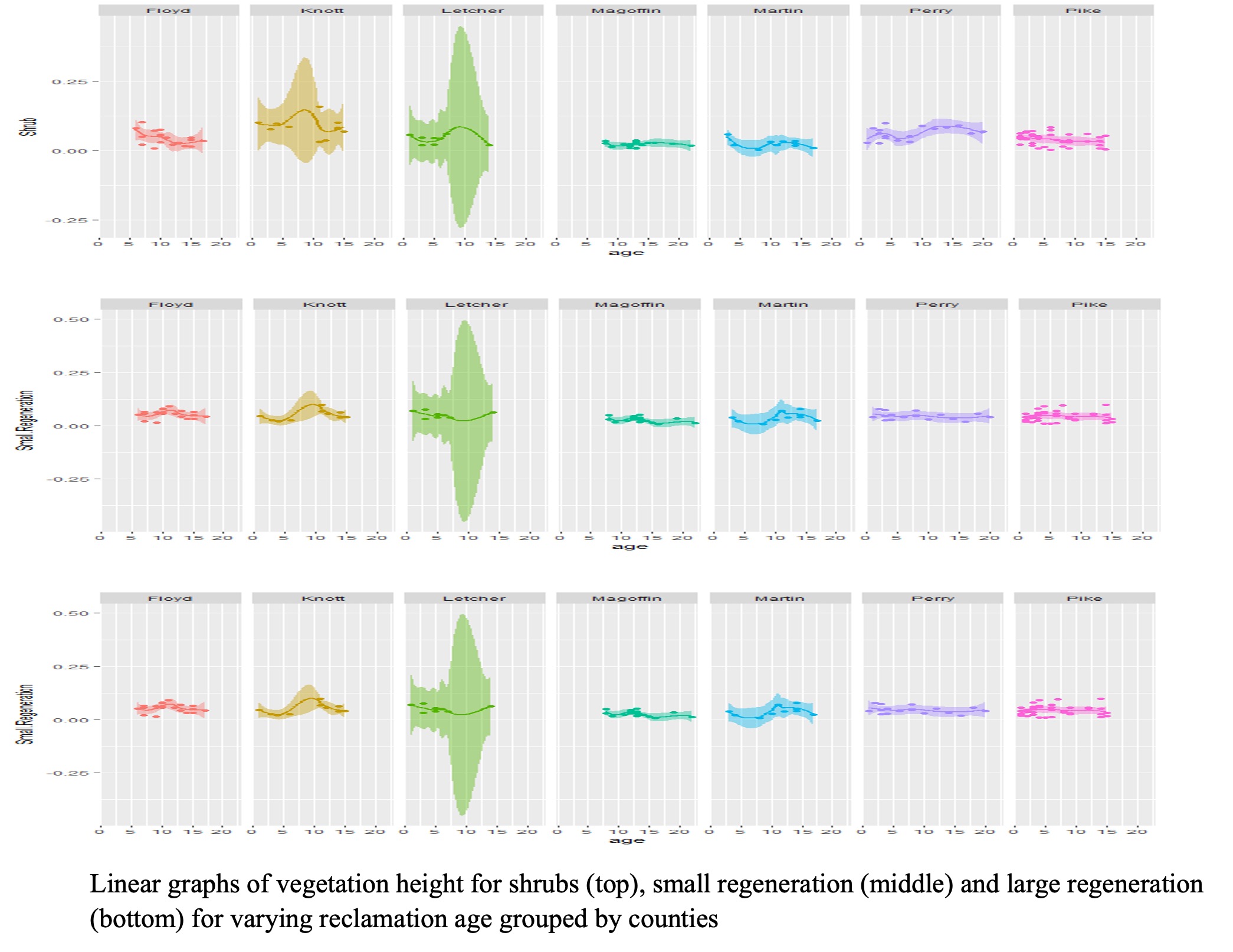
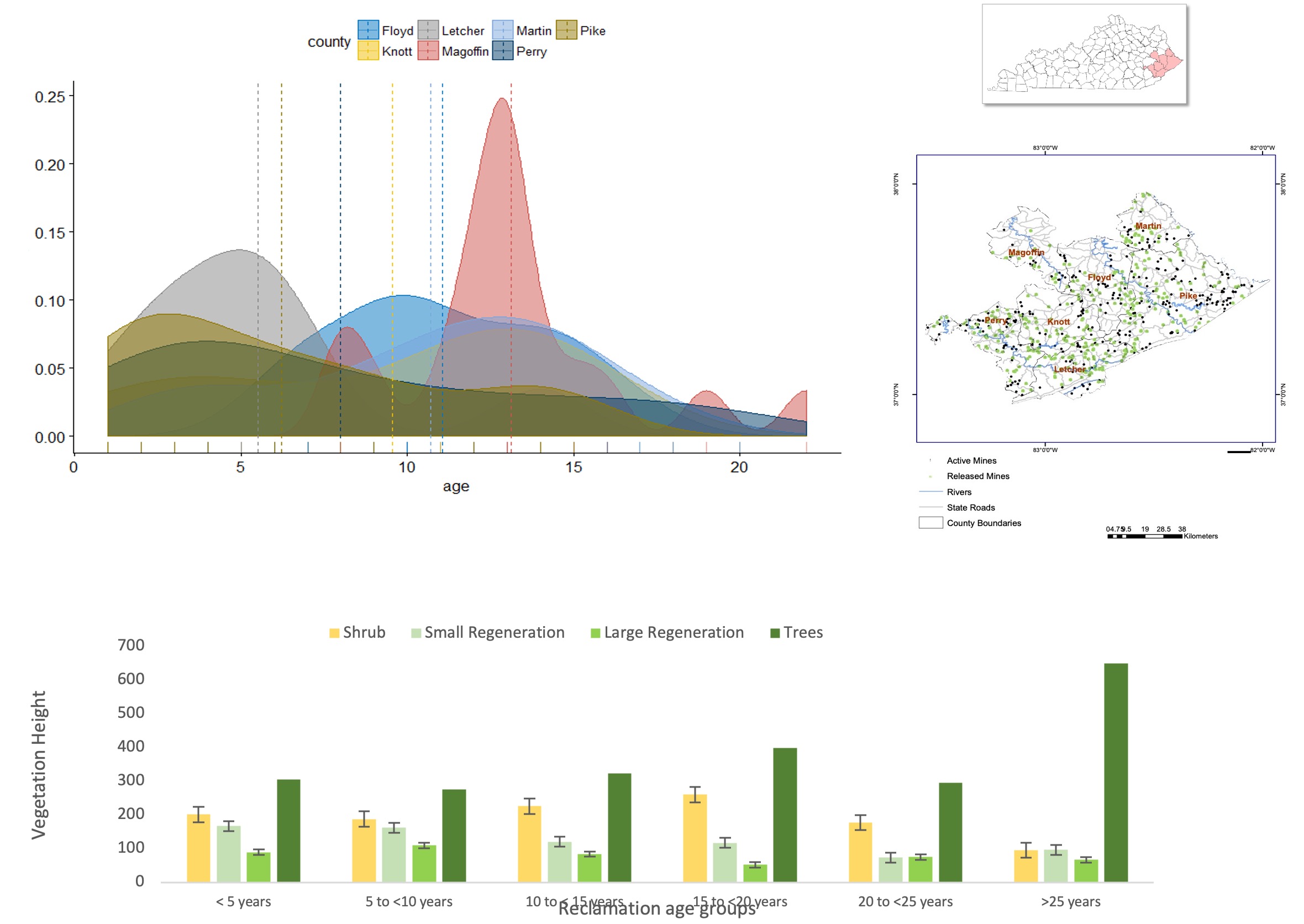
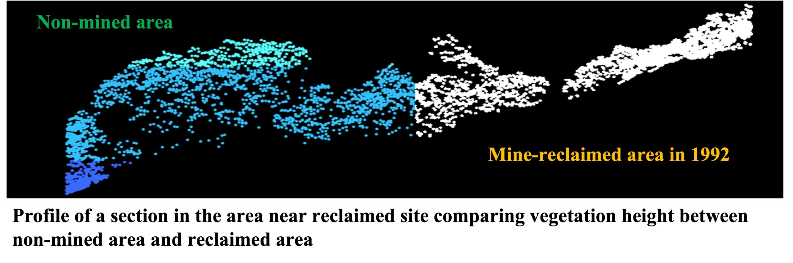
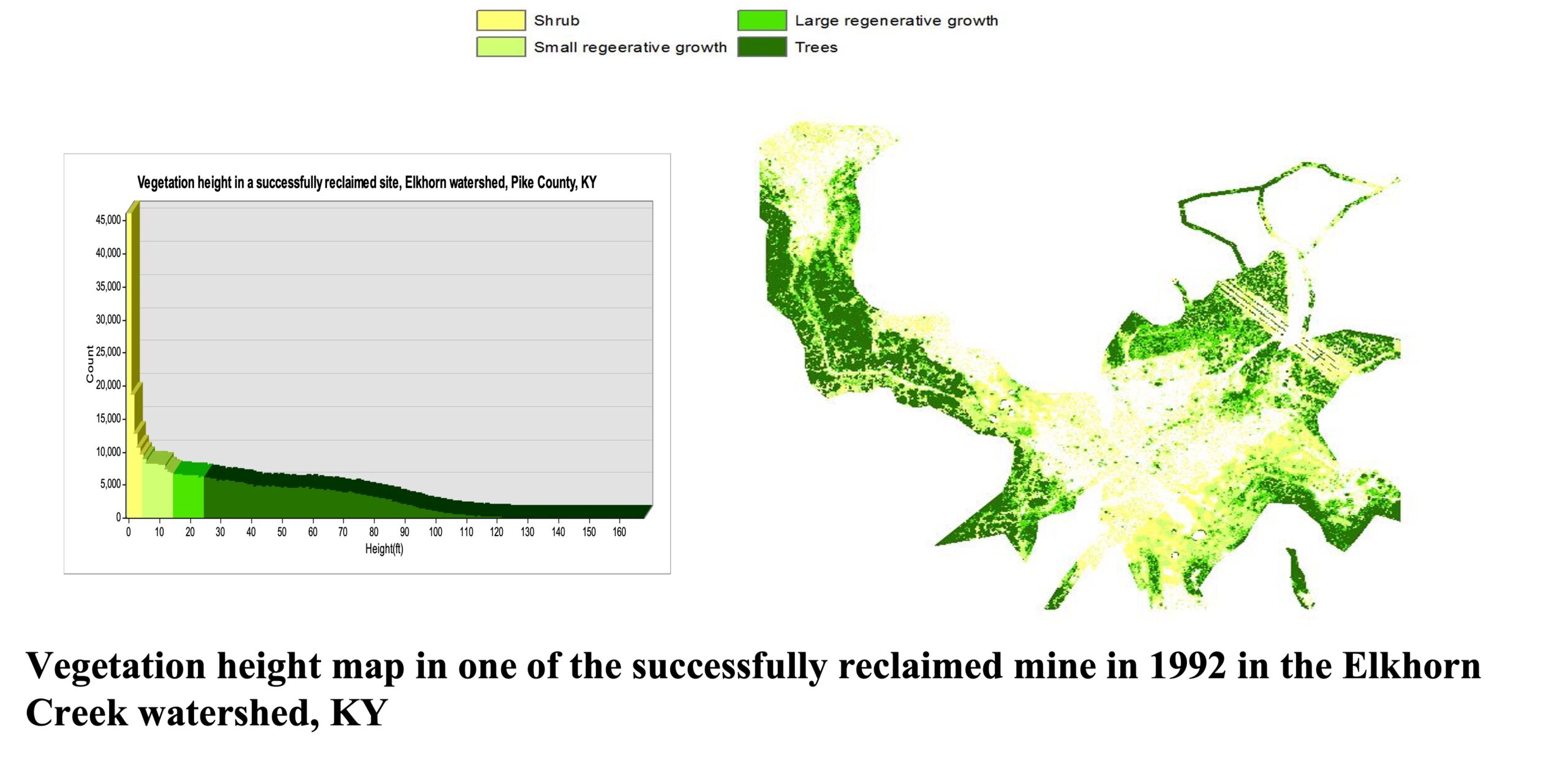
I led this study to estimate vegetation height in reclaimed mine sites of varying reclamation age and assess the success of reclamation based on vegetation height. It was one of the studies that I led in my role as the Research Assistant for the Geospatial Program at the Kentucky State University. LiDAR data was used to estimate the vegetation height in seven counties: Floyd, Knott, Letcher, Magoffin, Martin, Perry, Pike. A total of 112 releases sites were found in the seven counties. For statistical analyses, vegetation height was categorized into three groups of shrub (1-5 feet), small regeneration (6-15 feet) and large regeneration (16-25 feet) and four reclamation groups: 1 to 5 years, 6-10 years, 11-15 years, and 16 to 22 years. The graphs on the bottom show the results from the survey that collected demographic, socioeconomic information and perceptions of local people towards surface coal mining in the 7 study counties.