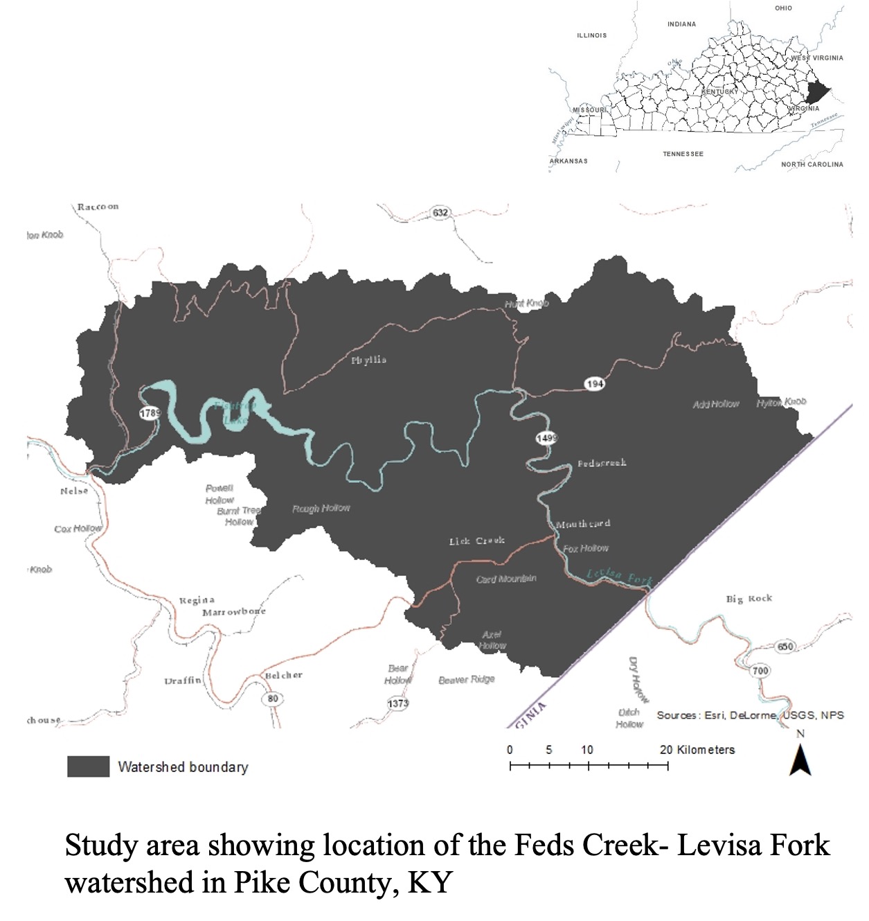
Land cover change and forest fragmentation in heavily coal-mined areas: A case study in Feds creek-Levisa Fork watershed in Eastern Kentucky
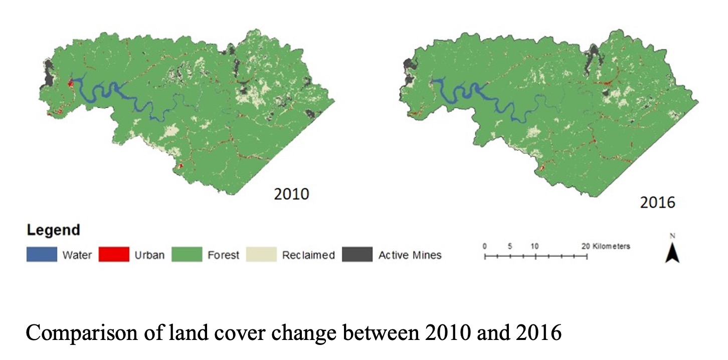
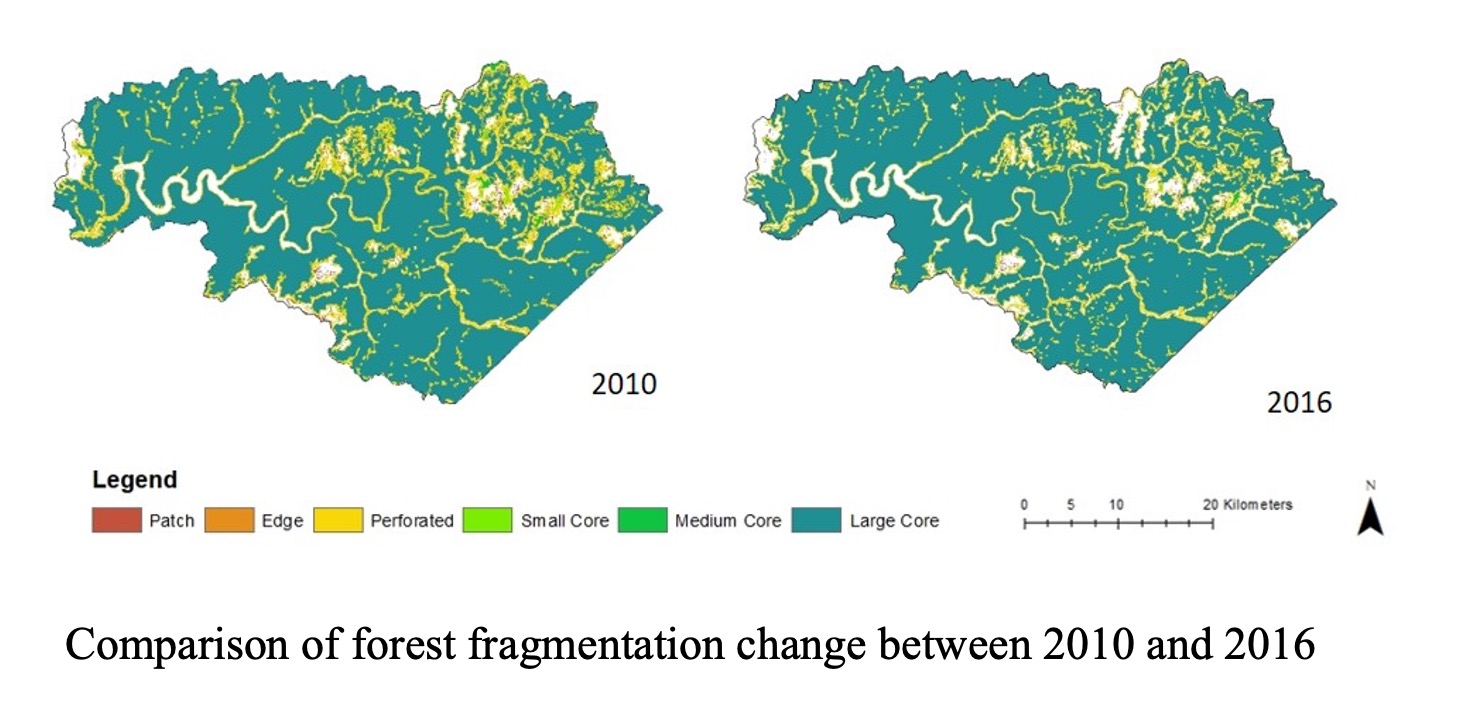
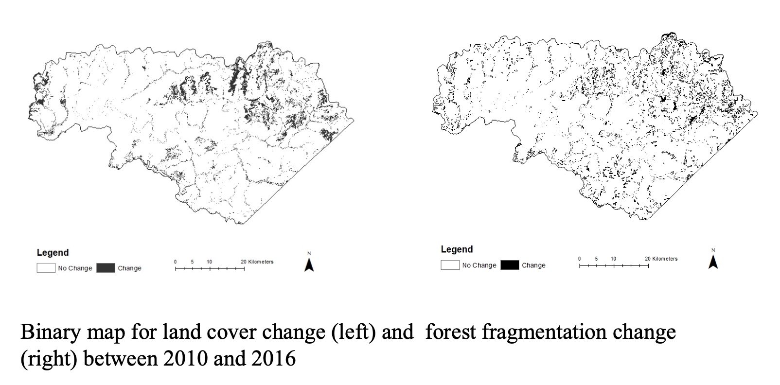
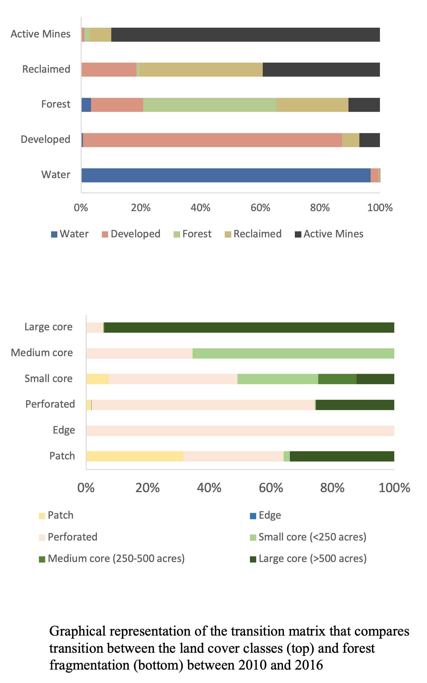
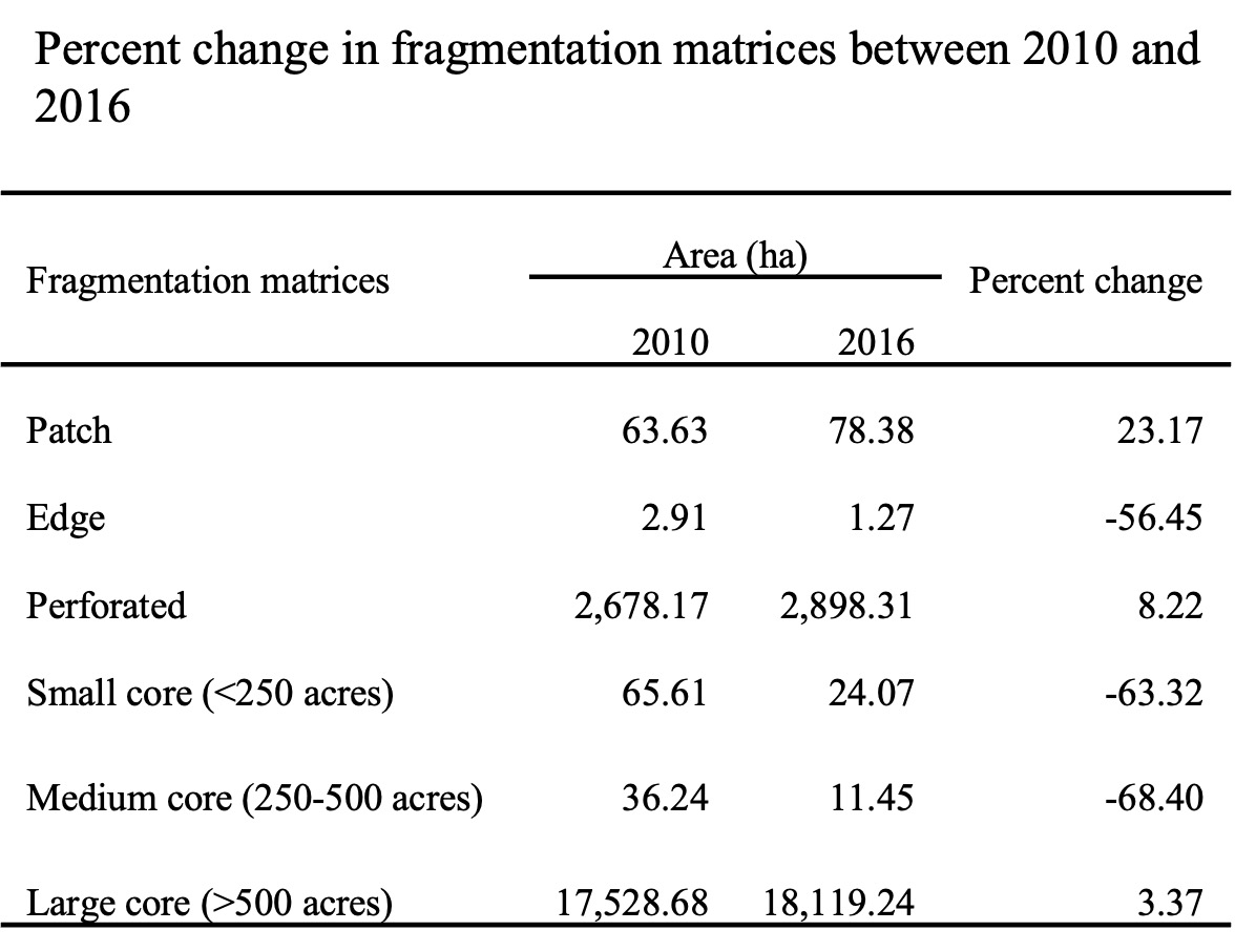
This study investigates the spatial extent and temporal trends of land cover change and forest fragmentation between 2010 and 2016 in Feds Creek-Levina Fork watershed in Pike County, KY. It was one of the studies that I led in my role as the Research Assistant for the Geospatial Program at the Kentucky State University. The National Agriculture Imagery Program (NAIP) imagery were used to classify five major land cover classes: water, developed/urban, forest, crop/grass/reclaimed, and active mines. The land cover was further analyzed using Landscape Fragmentation tool to assess the forest fragmentation using four major fragmentation matrices: patch, edge, perforated, and core. Results show an overall decrease in areas of all land cover classes except forest from 2010 to 2016. Land cover conversion results show majority of the increase in forested area were contributed by conversion of crop/grass/reclaimed land and actively mined sites. Comparison of forest fragmentation between 2010 and 2016 indicates significant decrease in edge and small and medium core forest areas, but significant increase in patch, perforated and large core forest areas indicating success of reclamation activities in the watershed through establishment of vegetation and conversion of grasslands to forested areas in the reclaimed sites.