State of Kentucky – Land cover change map book (1992-2011)
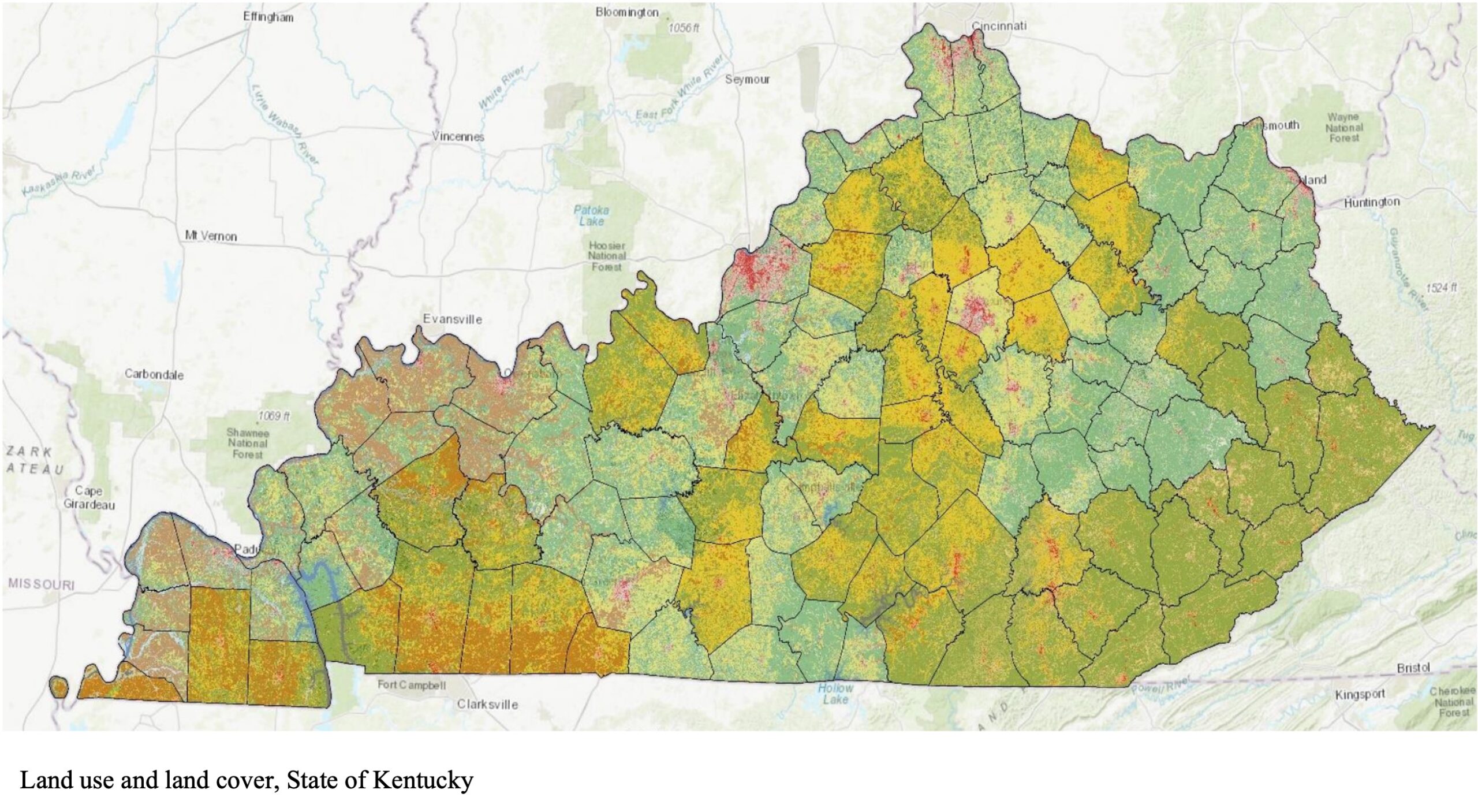
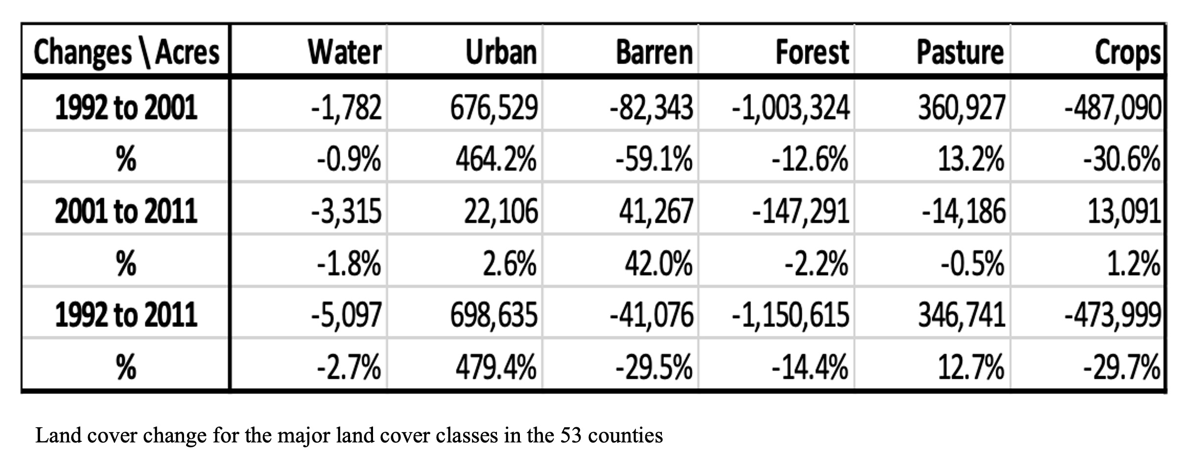
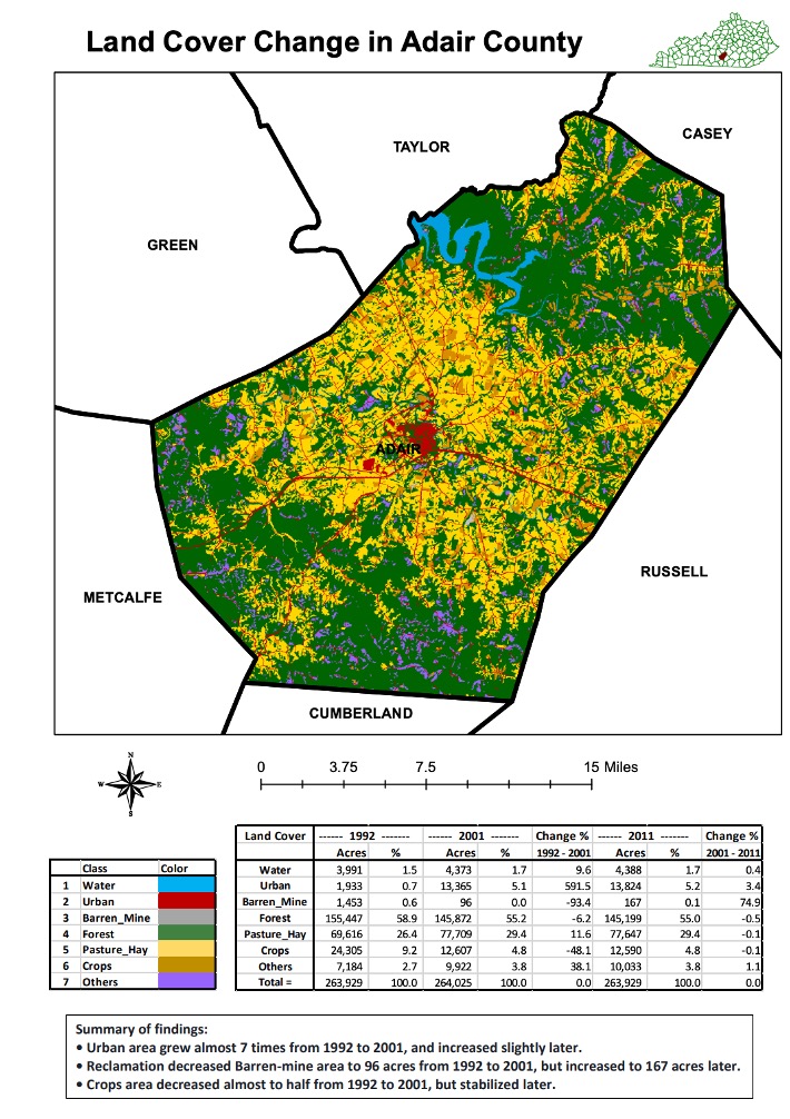
This map book contains land cover change maps for 53 counties in Kentucky based on the land cover information from the NLCD ‘National Land Cover Database.’ I worked with a postdoctoral researcher, Tilak Shrestha and Professor of geospatial applications, Dr. Buddhi Gyawali at the Kentucky State University in preparing the map book while I was working as the Research Assistant for the Geospatial Program at the university. A land cover map for each of the 53 counties is provided along with information on percent change between 1992, 2001 and 2011 for seven major land cover classes of interest, water, urban, barren mine, forest, pasture/hay, crops and others, and summary of the findings for each county. You can find the map book here.