Prevalence of concentrated flow paths in agricultural fields in southern Illinois
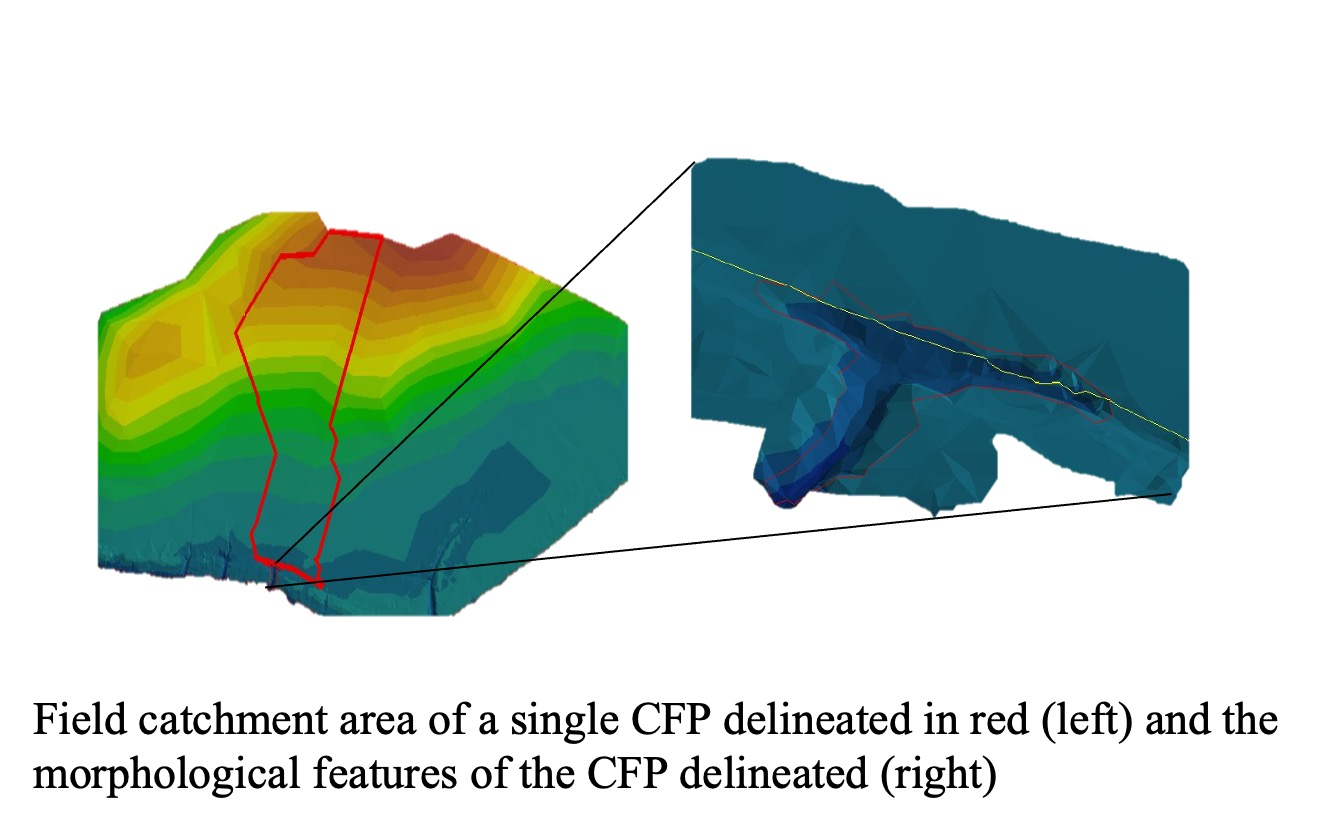
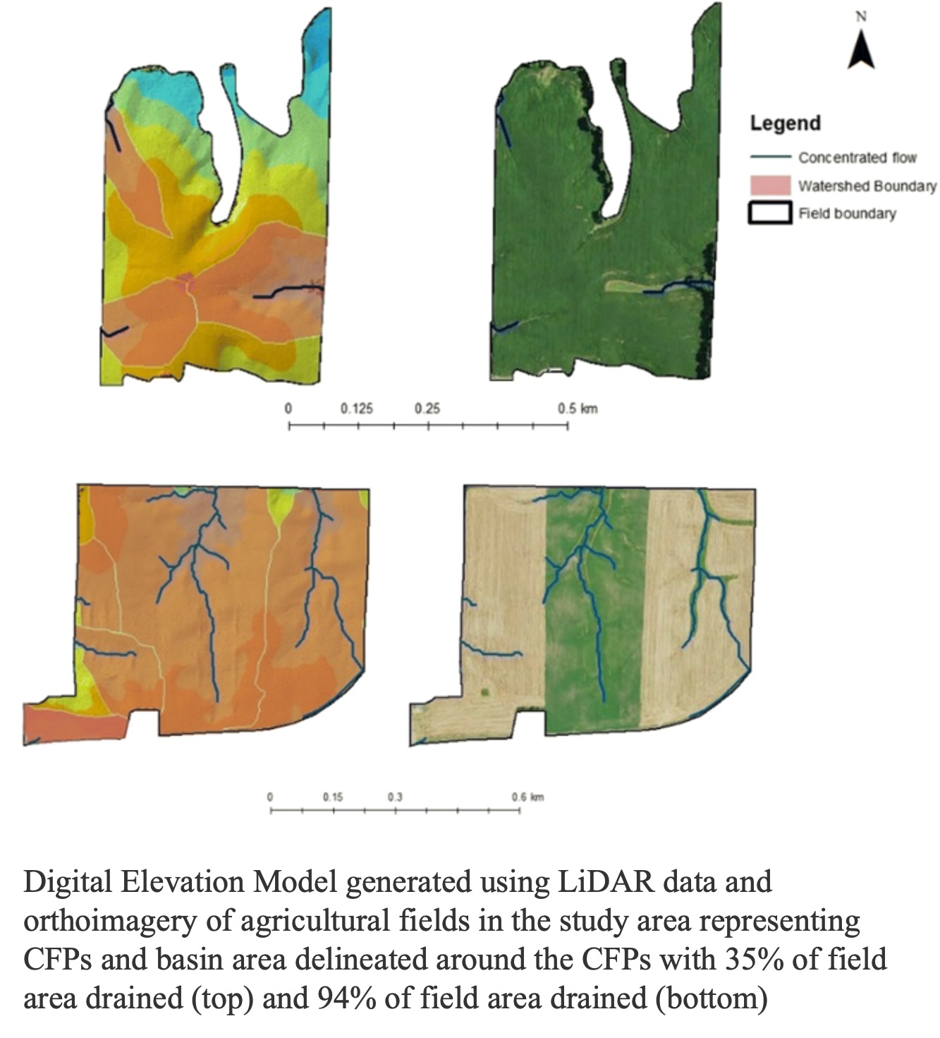
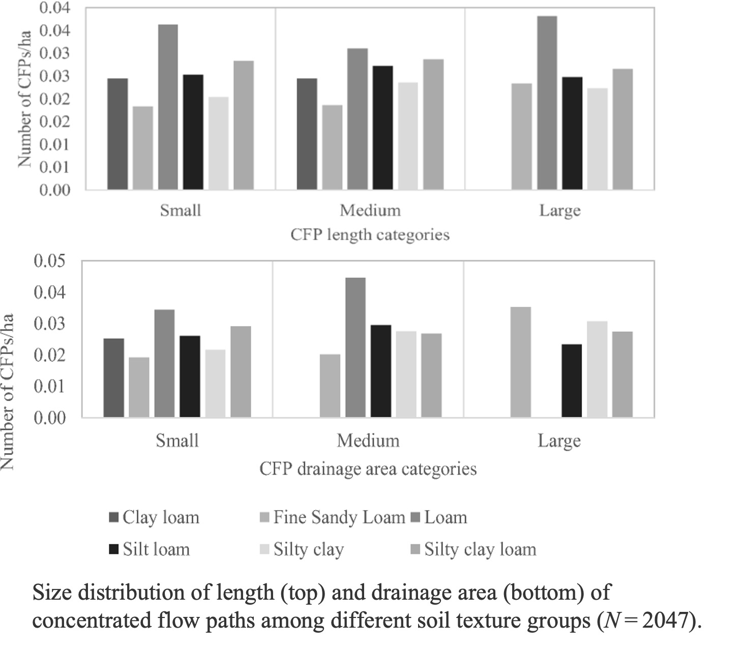
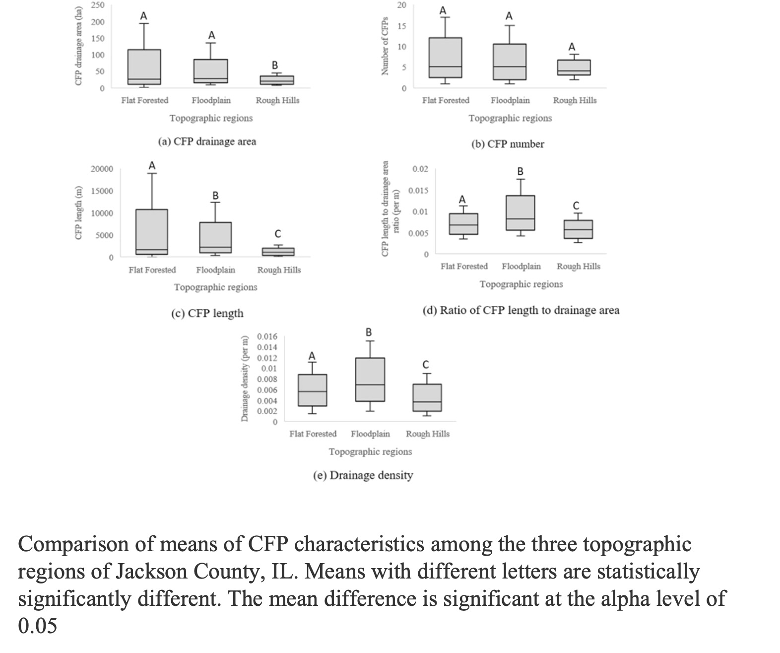
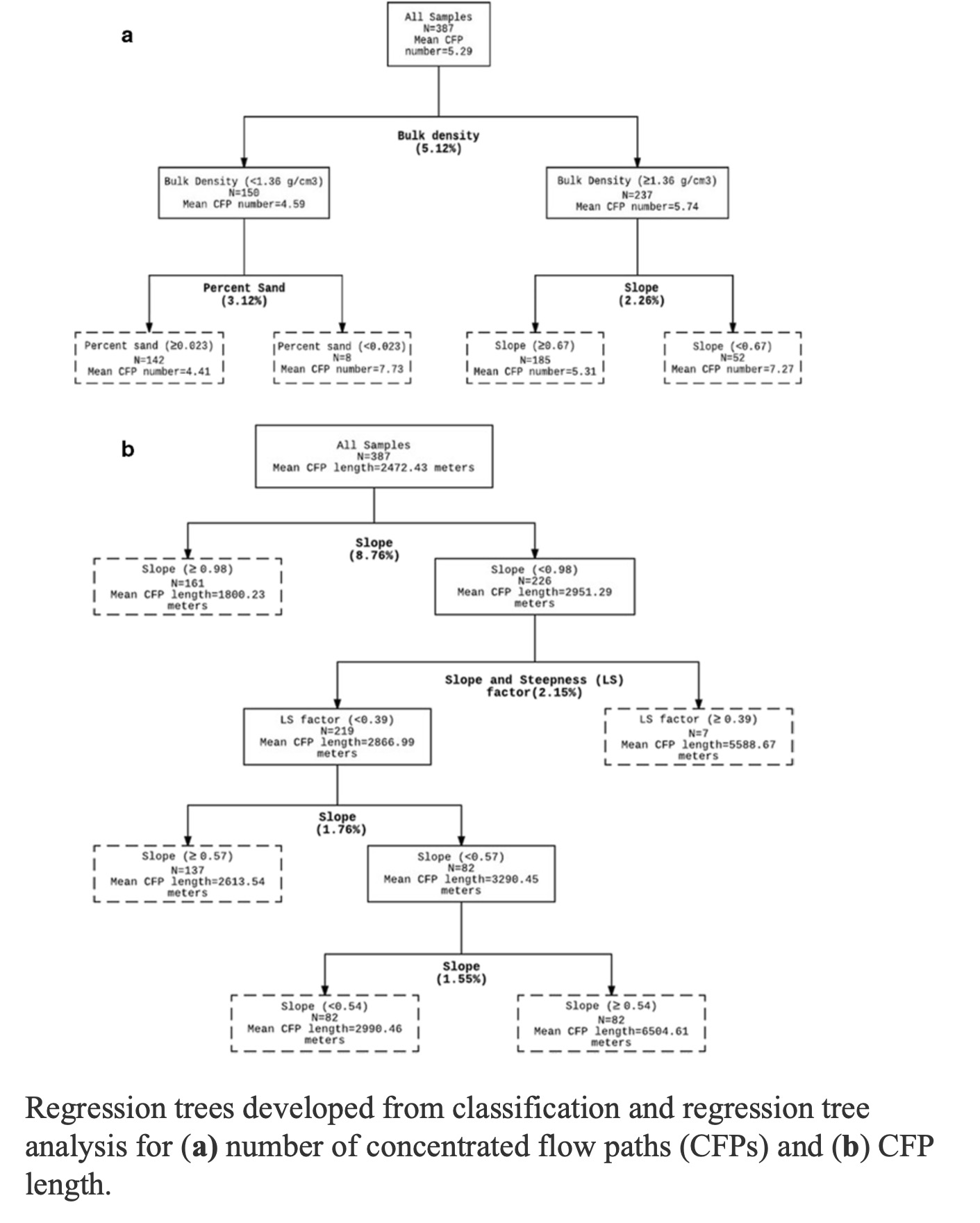
This is the research study I worked on for my Master’s research. This study used high-resolution Light Detection and Ranging (LiDAR) data to identify CFPs in agricultural fields and calculate the percentage of the fields drained by CFPs at a county scale. In 389 agricultural fields across Jackson County, southern Illinois, the mean number of CFPs in a field was 5 with a minimum of 0 and maximum of 17 CFPs. The majority of the CFPs fell under the large category for CFP length and drainage area that corresponds with high mean percent (81%) of field area drained by the CFPs. Further, 85% of the fields had more than 70% of their area drained by CFPs. You can find the manuscript published based on this work here.